You Won’t Believe How Manila’s Terrain Changes Everything
Manila isn’t just skyscrapers and traffic—you’ve gotta see how its special terrain shapes the whole travel experience. From reclaimed coastal zones to river-cut districts, the city’s geography sneaks into every ride, walk, and view. I never expected elevation shifts in a tropical capital could be so mind-blowing. This is real urban jungle navigation—wetlands, flood-prone streets, and hillside neighborhoods all in one day. Let me show you how understanding the land unlocks smarter, smoother adventures.
Welcome to Manila’s Hidden Geography
Most travelers picture Manila as a sprawling metropolis of concrete and chaos, but beneath the surface lies a surprisingly complex landscape shaped by water, elevation, and centuries of human adaptation. The city sits on a low-lying coastal plain bordered by Manila Bay to the west and the Sierra Madre mountain range to the east. What many don’t realize is that large parts of central Manila are built on land that was once submerged—reclaimed from tidal flats, lagoons, and river deltas. Areas like Bay City and parts of Parañaque were created through decades of landfill projects, transforming shallow waters into commercial and residential zones.
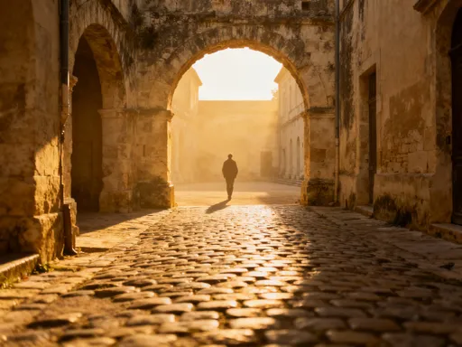
This engineered geography has lasting implications. The ground beneath modern developments is often less stable than natural soil, leading to gradual subsidence in some districts. In places like Mall of Asia Complex or Entertainment City, you’re literally walking on ground that didn’t exist 50 years ago. Meanwhile, historic districts such as Intramuros rest on more compacted, ancient alluvial deposits, giving them slightly higher elevation and better drainage compared to newer areas. These subtle differences in terrain affect everything from building foundations to walking comfort during rainy days.
The Pasig River, which cuts through the heart of the city, further divides the urban fabric into distinct zones with varying topography. North of the river, areas like Binondo and San Miguel sit just above sea level, while southward expansions into Makati and Taguig climb slightly higher due to natural ridges and uplifted terrain. Even within a few kilometers, elevation can shift by several meters—enough to influence water flow, air circulation, and pedestrian accessibility. For the observant traveler, these changes offer a hidden map of the city’s evolution and resilience.
Understanding this layered geography allows visitors to move with greater awareness. It explains why some neighborhoods feel drier and more walkable, while others seem perpetually damp or congested. It also reveals how Manila’s identity isn’t just cultural or historical—it’s deeply geological. Recognizing the city’s physical foundation helps travelers appreciate not only its challenges but also its ingenuity in adapting to an ever-shifting environment.
Why Terrain Matters More Than You Think
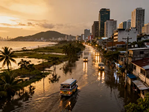
In Manila, the land doesn’t just support the city—it actively shapes daily life, especially during the rainy season. Much of the metropolitan area lies less than five meters above sea level, making it highly vulnerable to flooding when heavy rains coincide with high tides. Districts like Marikina, located along the Marikina River, are particularly prone to seasonal overflow, with floodwaters sometimes reaching residential streets and major roads. While flood control systems like the Manggahan Floodway help divert excess water, terrain limitations mean that certain areas will always be at higher risk.
For tourists, this reality translates into practical travel considerations. A sudden downpour can turn a simple commute into a multi-hour delay, especially in low-lying zones where drainage is slow. Streets in areas like Santa Mesa or parts of Quezon City may become impassable, forcing reroutes and extended travel times. Public transport schedules can be disrupted, and ride-hailing apps might struggle to find available drivers willing to enter flooded zones. Knowing which areas are more susceptible allows travelers to plan accordingly—choosing routes and accommodations that minimize exposure to these risks.
Beyond inconvenience, terrain-related flooding can impact health and comfort. Standing water increases humidity levels, accelerates mold growth, and raises the risk of waterborne illnesses. Footwear can stay wet for hours, leading to discomfort or skin irritation. Even indoor spaces in flood-prone areas may feel damp, with musty odors and reduced air quality. Travelers with mobility concerns may find navigating flooded sidewalks especially challenging, as curbs disappear and temporary wooden planks become the only path forward.
Yet, awareness brings advantage. By understanding Manila’s topographical vulnerabilities, visitors can anticipate conditions rather than react to them. This means scheduling outdoor activities during drier months, selecting hotels on higher ground, and packing gear suited for wet environments. It also fosters empathy for local residents who live with these conditions year after year. Terrain isn’t just a backdrop—it’s a dynamic force that demands respect and smart planning. When travelers align their itineraries with the city’s natural rhythms, they gain not only smoother journeys but deeper insight into Manila’s resilience.
Getting Around: Roads, Rivers, and Rides
Navigating Manila requires more than just knowing your destination—it demands an understanding of how terrain influences movement across the city. The capital’s road network is a patchwork of elevated expressways, sunken avenues, and narrow side streets, each responding differently to the underlying landscape. Jeepneys, the iconic public vehicles, often struggle on routes that pass through low-lying or poorly drained areas, where even moderate rain can create deep puddles or submerged sections. Drivers must slow down, detour, or sometimes stop entirely until waters recede, disrupting schedules and increasing commute times.
Bridges play a crucial role in connecting fragmented zones separated by rivers and esteros (small waterways). Structures like the Ayala Bridge or Guadalupe Bridge serve as vital links between Makati and Manila proper, allowing traffic to flow over the Pasig River despite fluctuating water levels. During peak flooding, however, some bridges become chokepoints as vehicles queue for limited dry passage. Elevated roads like the Skyway and C-5 Link provide alternatives by rising above flood-prone corridors, offering faster transit during wet weather. These elevated routes are increasingly important as climate patterns intensify rainfall events.
Water transport, long overlooked, is experiencing a revival as a terrain-adaptive solution. The Pasig River Ferry Service, though still limited in coverage, offers a reliable alternative for those traveling along the riverbanks. Unlike road-based options, ferries are unaffected by traffic congestion and can operate even when adjacent streets are flooded. Expansion plans aim to increase terminals and frequency, potentially integrating river travel into mainstream commuting. For tourists, a ferry ride provides not only a unique perspective of the city but also a practical way to avoid ground-level delays.
Technology further enhances mobility in this complex environment. Navigation apps like Waze and Google Maps now include real-time flood alerts and user-reported road conditions, helping drivers avoid submerged streets or blocked intersections. Some platforms even suggest alternate routes based on current water levels. For pedestrians, digital maps can highlight elevated walkways or covered pathways that remain accessible during rain. Carrying a power bank is wise, as long commutes may drain phone batteries needed for navigation and communication. By combining terrain awareness with smart tools, travelers can navigate Manila’s shifting landscape with greater confidence and efficiency.
Best Areas to Stay Based on Elevation & Access
Choosing where to stay in Manila isn’t just about proximity to attractions—it’s also about elevation, drainage, and access to reliable transportation. Makati City, one of the most popular destinations for visitors, sits on relatively higher ground compared to other business districts. Its central business district features well-planned infrastructure, elevated sidewalks, and efficient drainage systems, making it less prone to flooding. Hotels here often cater to international guests with climate-controlled interiors and secure access, providing a comfortable base even during rainy periods. The area’s walkability, combined with its connectivity to other parts of the city via the MRT and major roads, makes it a top choice for those seeking both convenience and stability.
Malate and Ermita, located closer to Manila Bay, offer a different experience—one that blends history, culture, and coastal charm. However, their lower elevation and proximity to the bay make them more vulnerable to tidal surges and drainage issues during heavy rains. While many hotels in these areas have adapted with elevated entrances and backup generators, street-level flooding can still affect mobility. That said, their location near cultural landmarks like Rizal Park and Manila Cathedral, as well as a wide range of dining and shopping options, keeps them attractive to travelers who prioritize atmosphere over absolute elevation.
Quezon City, situated further inland and spanning a larger geographic area, presents a mix of conditions. Areas like Cubao and Eastwood City benefit from better drainage and are generally considered safer from flooding. The district’s distance from the coast reduces tidal influence, and its network of radial roads provides multiple access points. For families or longer-term stays, Quezon City offers spacious accommodations, green spaces like La Mesa Eco Park, and proximity to universities and embassies. However, traffic congestion can be heavier due to the volume of commuters, so staying near MRT stations or major thoroughfares improves accessibility.
Newer developments in Bonifacio Global City (BGC) in Taguig have been engineered with modern flood mitigation in mind. The area features elevated roads, underground drainage systems, and strict zoning regulations that prevent construction in high-risk zones. BGC’s pedestrian-friendly design, landscaped walkways, and integrated transport options make it ideal for travelers who value order and comfort. While slightly removed from historic Manila, its proximity to Ninoy Aquino International Airport and world-class amenities justify its appeal. Ultimately, selecting a neighborhood should balance personal priorities—whether it’s cultural immersion, business needs, or terrain safety—with an understanding of how elevation and infrastructure shape the guest experience.
When to Visit: Aligning with Terrain Challenges
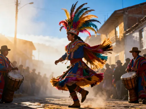
Timing your trip to Manila can significantly affect your experience, largely due to the interplay between weather patterns and the city’s vulnerable terrain. The dry season, which runs from November to April, is widely regarded as the best time to visit. During these months, rainfall is minimal, humidity is relatively lower, and flood risks are greatly reduced. Streets remain passable, outdoor activities proceed without interruption, and transportation flows more smoothly. This period also coincides with major festivals like the Feast of the Black Nazarene in January and local fiestas across barangays, offering rich cultural experiences without the complications of adverse weather.
In contrast, the rainy season—from June to October—brings frequent downpours and the threat of typhoons, which can severely impact travel plans. Typhoons often cause prolonged rainfall that overwhelms drainage systems, leading to widespread flooding in low-lying areas. Roads may close, flights can be delayed or canceled, and public services may operate on reduced schedules. While the city is accustomed to these events and emergency protocols are in place, visitors unfamiliar with the conditions may find themselves stranded or inconvenienced. Heavy rains can also dampen outdoor exploration, limit visibility, and increase the risk of slips or electrical hazards in flooded zones.
That said, the shoulder months—May and November—offer a balanced alternative. May marks the transition from dry to wet season, with rising temperatures but still manageable rainfall. It’s an excellent time to enjoy sunny days before the rains intensify. November, after the peak typhoon window, often sees clearer skies returning, with fewer tourists and more pleasant conditions. These transitional periods allow travelers to experience Manila’s vibrancy without facing the extremes of either season.
Monitoring weather forecasts before and during your trip adds another layer of preparedness. The Philippine Atmospheric, Geophysical and Astronomical Services Administration (PAGASA) issues regular updates on rainfall, wind speeds, and storm signals, which can be accessed online or through local news. Staying informed enables real-time adjustments—rescheduling excursions, choosing indoor activities, or extending hotel stays when necessary. By aligning travel dates with terrain realities, visitors not only enhance their comfort but also demonstrate respect for the city’s environmental rhythms.
What to Pack: Gear That Matches the Ground
Packing for Manila requires more than just clothes and toiletries—it demands gear that responds to the city’s humid climate, uneven sidewalks, and frequent rain. Standard urban footwear, such as leather shoes or open sandals, often fails on wet, slippery surfaces. Instead, travelers should opt for quick-drying, water-resistant shoes with good traction. Closed-toe sneakers or amphibious-style walking shoes perform well on flooded streets and offer protection from debris. Lightweight rain boots are another smart addition, especially during the wet season, allowing you to step through puddles without soaking your socks.
Clothing choices also need to adapt to the environment. Cotton fabrics absorb moisture and take hours to dry, making them uncomfortable in Manila’s sticky heat. Moisture-wicking materials like polyester blends or merino wool keep the body cooler and dry faster. Loose-fitting, breathable outfits help with airflow while shielding against sun exposure. A compact travel umbrella or a foldable raincoat is essential—sudden showers can occur at any time, and being caught unprepared leads to discomfort and potential health issues. Consider packing a lightweight poncho, which is easy to carry and provides full coverage without restricting movement.
Protecting electronics and documents is equally important. Waterproof phone cases or dry bags shield devices from splashes and downpours. Portable power banks ensure your phone stays charged during long commutes affected by traffic or rerouting. Offline maps downloaded via Google Maps or Maps.me allow navigation even when internet connectivity drops. A small, sealed plastic bag for storing wallets, passports, or tickets adds an extra layer of security when crossing flooded areas. These small preparations make a big difference in maintaining comfort and functionality throughout the day.
Additional items like antiseptic wipes, foot powder, and a microfiber towel help manage hygiene in humid conditions. After walking through damp streets, wiping down shoes and feet prevents odor and irritation. A reusable water bottle with a filter ensures safe hydration without relying on single-use plastics. By tailoring your packing list to Manila’s terrain, you shift from reacting to problems to preventing them—transforming potential frustrations into seamless experiences.
Beyond the City: Day Trips Shaped by Landscape
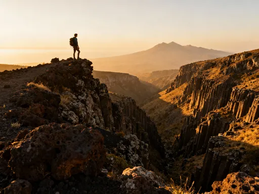
Stepping outside Manila reveals how terrain defines not just the capital but the entire region’s travel possibilities. One of the most striking contrasts is Tagaytay, a highland city perched over 600 meters above sea level, just two hours south of the metropolis. Here, the cool mountain air, rolling hills, and panoramic views of Taal Volcano create a dramatic departure from Manila’s flat, humid landscape. The elevation provides natural relief from the lowland heat, making it a favored weekend getaway for families and couples alike. Well-paved roads and scenic viewpoints allow easy access, while local restaurants serve warm dishes uncommon in the tropical capital.
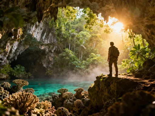
Another terrain-driven escape is Pico de Loro in Nasugbu, Batangas. This coastal cliff formation rises sharply from the sea, offering breathtaking vistas and rugged hiking trails. The area’s dramatic elevation changes—from beach level to forested peaks—create microclimates that support diverse plant and animal life. Resorts built into the hillsides take advantage of the terrain, providing guests with elevated pools and open-air lounges that frame the ocean below. Access involves a drive through winding coastal roads, reminding travelers of how geography shapes infrastructure and travel time.
For those interested in geological history, the Banaue Rice Terraces—though farther north—illustrate how terrain has shaped human settlement for centuries. Carved into mountainsides over 2,000 years ago, these UNESCO-listed terraces demonstrate sustainable land use in steep environments. While not a day trip from Manila, shorter excursions to similar landscapes in Rizal or Laguna offer glimpses of how elevation and water management define rural life. Even nearby hot springs in Los Baños owe their existence to volcanic activity beneath the region’s surface, proving that the land’s story is written deep below ground.
These trips do more than offer recreation—they provide context. By experiencing highlands, coastlines, and volcanic formations, travelers gain a fuller understanding of the forces that shape Manila itself. The city’s vulnerability to water, its reliance on engineered solutions, and its constant adaptation all make more sense when seen alongside these natural counterparts. Choosing terrain-informed excursions enriches the journey, turning sightseeing into meaningful exploration.
Manila’s terrain isn’t just background—it’s a silent guide shaping every decision. By respecting its rhythms, travelers gain not just safety and comfort, but deeper connection to the city’s soul. Let the land lead you.